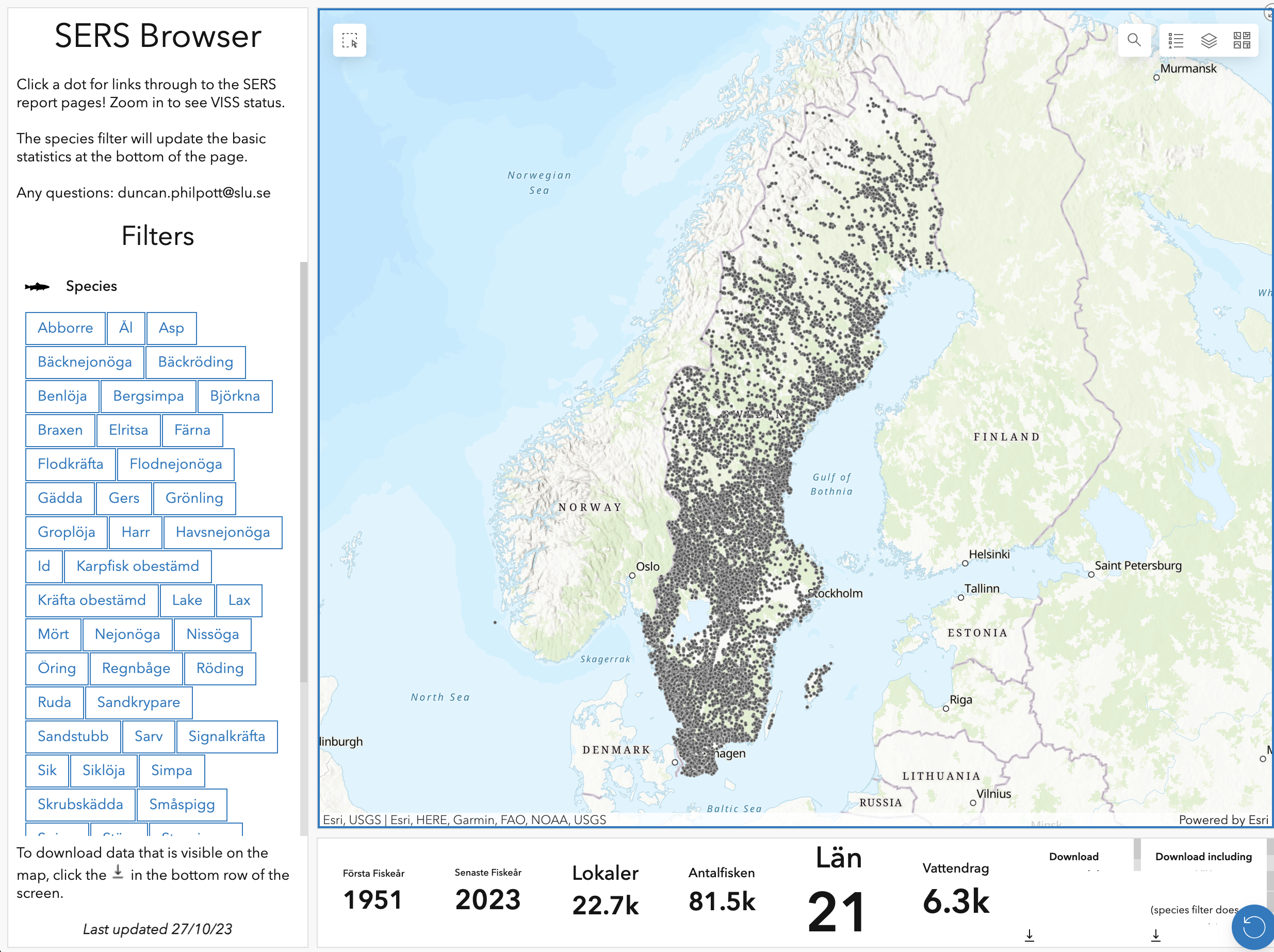
SERS ESRI Dashboard
The Swedish Electrofishing Register (SERS) is a comprehensive database that records electrofishing data in Sweden. It serves as a vital tool for researchers and policymakers, providing valuable insights into the health and abundance of aquatic populations, helping to ensure effective conservation and management strategies for Swedish water bodies.
Use of SERS is a daily occurance to me and while the standard web form request, or fickle map to draw a polygon to create a site selection is not the most user-friendly I exported the data to an ESRI dashboard to allow for easy browsing.
Features:
- Interactive data points, click for more information about the site with links through to SERS Aqua reports / VISS pages
- Species filters (all recorded species in SERS)
- Real time basic statistics
- First electrofishing date for species
- Number of sites where the species is present
- Number of counties where the species is present
- Number of watercourses where the species is present
- Number of electrofishing occasions
- VISS classification, currently only ecological, but please let me know if you want other layers
- Complete legend (must be enabled using one of the icons in the upper right of the map screen)
- Changeable baselayers, satellite imagery etc.
- Data download for aggregated and individual electrofishing events.
